
[Geological Survey (U. S.),
[Kansas, Abilene sheet, Abil
1894
|

[Geological Survey (U. S.),
[Kansas, Abilene sheet, Abil
1908
|

[Geological Survey (U. S.),
[Kansas, Abilene sheet, Abil
1908
|

[Geological Survey (U. S.),
[Kansas, Abilene sheet, Abil
1933
|

[Geological Survey (U. S.),
[Kansas, Abilene quadrangle,
1949
|

maps
[Geological Survey (U.S.), T
[Colo.-Kans, Albany sheet, A
[1893 (edition), 1946 (repri
|

[Geological Survey (U. S.),
[Kansas, Andover quadrangle
1945
|

maps
[Geological Survey (U.S.), G
[Anthony quadrangle, Kansas
[1891 (edition), 1949 (repri
|

Geological Survey (U. S.)
[Antioch quadrangle, Nebrask
1949
|
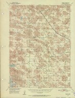
Geological Survey (U. S.)
[Arabia quadrangle, Nebraska
1950
|

maps
[Geological Survey (U.S.), G
[Nebraska-Kansas Arapahoe qu
[1896 (edition), 1949 (repri
|

Geological Survey (U. S.)
[Arthur quadrangle, Nebraska
1950
|

Geological Survey (U. S.)
[Ashby quadrangle, Nebraska
1948
|

Geological Survey (U. S.)
[Ashby quadrangle, Nebraska
1955
|

maps
[Geological Survey (U.S.), G
[Kansas Ashland sheet, Ashla
1896 (edition)
|

maps
[Geological Survey (U.S.), G
[Kansas-Missouri Atchison sh
1893 (edition)
|

maps
[Geological Survey (U.S.), G
[Kansas Beloit sheet, Beloit
[1894 (edition), 1904 (repri
|

Geological Survey (U. S.)
[Big Falls quadrangle, Nebra
1951
|

Geological Survey (U. S.)
[Bingham quadrangle, Nebrask
1950
|

[Geological Survey (U. S.),
[Missouri (Jackson County),
1947
|

Geological Survey (U. S.)
[Brownlee quadrangle, Nebras
1951
|

Geological Survey (U. S.)
[Bull Lake quadrangle, Nebra
1951
|
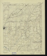
maps
[Geological Survey (U.S.), G
[Kansas Burden sheet, Burden
[1889 (edition), 1932 (repri
|
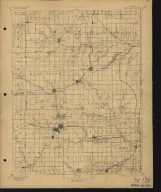
maps
[Geological Survey (U.S.), G
[Kansas Burlingame sheet, Bu
[1894 (edition), 1906 (repri
|

maps
[Geological Survey (U.S.), G
[Kansas Burlington quadrangl
[1949 (reprint), 1894 (editi
|

[Geological Survey (U. S.),
[Kansas, Burlington quadrang
1949
|

maps
[Geological Survey (U.S.), G
[Kansas Caldwell sheet, Cald
1897 (edition)
|

Geological Survey (U. S.)
[Carr Lake quadrangle, Nebra
1950
|
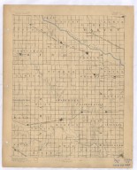
maps
[Geological Survey (U.S.), G
[Kansas Cheney sheet, Cheney
1889 (edition)
|

maps
[Geological Survey (U.S.), T
[Col.-Kans., Cheyenne Wells
[1894 (edition), 1949 (repri
|

Geological Survey (U. S.)
[Cody Lake quadrangle, Nebra
1951
|

Geological Survey (U. S.)
[Cody quadrangle, Nebraska-S
1950
|

maps
[Geological Survey (U.S.), G
[Kansas Coldwater sheet, Col
[1892 (edition), 1945 (repri
|
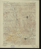
maps
[Geological Survey (U.S.), G
[Kansas Concordia sheet, Con
[1892 (edition), 1934 (repri
|

maps
[Geological Survey (U.S.), G
[Kansas Cottonwood Falls qua
1898 (edition)
|

Geological Survey (U. S.)
[Crescent Lake quadrangle, N
1950
|

Geological Survey (U. S.)
[Dismal River Ranch quadrang
1949
|

maps
[Geological Survey (U.S.), B
[Kansas Dodge sheet, Dodge s
[1892 (edition), 1906 (repri
|

[Geological Survey (U. S.),
[Dorchester quadrangle, Nebr
1940
|

Geological Survey (U. S.)
[Doughboy quadrangle, Nebras
1952
|

Geological Survey (U. S.)
[Dunning quadrangle, Nebrask
1951
|

maps
[Geological Survey (U.S.), G
[Kansas Eldorado sheet, Eldo
[1888 (edition), 1932 (repri
|
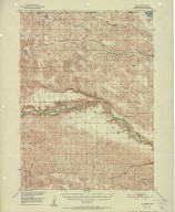
Geological Survey (U. S.)
[Eli quadrangle, Nebraska-So
1952
|

maps
[Geological Survey (U.S.), G
[Kansas Ellis quadrangle, El
[1893 (edition), 1949 (repri
|

maps
[Geological Survey (U.S.), G
[Kansas Ellsworth sheet, Ell
[1894 (edition), 1941 (repri
|

maps
[Gannett, Henry, 1846-1914.,
[Kansas Emporia sheet, Empor
[1894 (edition), 1906 (repri
|

maps
[Geological Survey (U.S.), G
[Kansas Eskridge sheet, Eskr
[1894 (edition), 1906 (repri
|

maps
[Geological Survey (U.S.), G
[Kansas Eureka sheet, Eureka
[1894 (edition), 1925 (repri
|

[Geological Survey (U. S.),
[Falls City quadrangle, Nebr
1915
|

[Marshall, R. B., Tatum, Sle
[Falls City quadrangle, Nebr
1949
|