Detail View: Maps and Cartography: Beloit sheet
|
Identifier:
|
trmp_ma_beloit_1894_1904_30min.tif
|
|
Title:
|
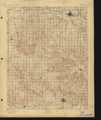
Kansas Beloit sheet
|
|
Title:
|
Beloit sheet
|
|
Citation:
|
Contributors: U.S. Geological Survey ; Henry Gannett, Chief Topographer ; Jno. H. Renshawe, Geographer in charge ; Triangulation by H.L. Baldwin Jr. ; U.S. Coast and Geodetic Survey ; Topography by R.M. Towson.
|
|
Name:
|
Geological Survey (U.S.)
|
|
Name:
|
Gannett, Henry, 1846-1914.
|
|
Name:
|
Renshawe, John H.
|
|
Name:
|
Baldwin, H. L. (Harry L.)
|
|
Name:
|
Towson, R. M.
|
|
Type:
|
maps
|
|
Genres:
|
maps, topographic
|
|
Location:
|
Washington, D.C.
|
|
Publisher:
|
U.S. Geological Survey
|
|
Edition:
|
Edition of Feb. 1894, reprinted Oct. 1904.
|
|
Publication Date:
|
1894 (edition)
|
|
Publication Date:
|
1904 (reprint)
|
|
Form:
|
1 map : col. ; 45 x 35 cm. on sheet 51 x 43 cm.
|
|
Subject:
|
Kansas -- Maps, Topographic
|
|
Continent:
|
North America
|
|
Country:
|
United States
|
|
State:
|
Kansas
|
|
County:
|
Lincoln County
|
|
Continent:
|
North America
|
|
Country:
|
United States
|
|
State:
|
Kansas
|
|
County:
|
Osborne County
|
|
Continent:
|
North America
|
|
Country:
|
United States
|
|
State:
|
Kansas
|
|
County:
|
Russell County
|
|
Continent:
|
North America
|
|
Country:
|
United States
|
|
Area:
|
Beloit quadrangle
|
|
Continent:
|
North America
|
|
Country:
|
United States
|
|
State:
|
Kansas
|
|
Continent:
|
North America
|
|
Country:
|
United States
|
|
State:
|
Kansas
|
|
County:
|
Mitchell County
|
|
Scale:
|
1:125,000.
|
|
Coordinates:
|
(W 98⁰30ʹ--W 98⁰/N 39⁰30ʹ--N 39⁰).
|
|
Classification:
|
3700s 125
|
|
Source:
|
T.R. Smith Map Collections, University of Kansas Libraries
|
|
Repository Name:
|
T.R. Smith Map Collections, University of Kansas Libraries
|
|
Repository Note:
|
Kansas 30 minute series
|